Geolocate

Feaster Park topographic map

Click on the map to display elevation.

About this map

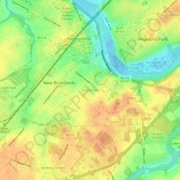
Name: Feaster Park topographic map, elevation, terrain.

Location: Feaster Park, New Brunswick, Middlesex County, New Jersey, 08901, United States (40.46455 -74.46265 40.50455 -74.42265)

Average elevation: 25 m

Minimum elevation: -4 m

Maximum elevation: 43 m

Other topographic maps

Click on a map to view its topography, its elevation and its terrain.

Gear up for your next adventure:

🛶Kayak Accessories - Essential gear for safe and fun kayaking adventures
🧢Hiking Hat - Sun-protective and breathable hats for long treks
🛏️Sleeping Bag - Warm and compact sleeping bags for outdoor camping
🧢Beanie Hat - Keep your head warm in cold weather
👟Trail Running Shoes - Agile footwear for fast-paced topographic exploration

As an Amazon Associate, this site earns from qualifying purchases at no extra cost to you.