Geolocate

Puertollano topographic map

Click on the map to display elevation.

About this map

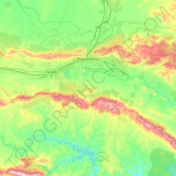
Name: Puertollano topographic map, elevation, terrain.

Location: Puertollano, Ciudad Real, Castile-La Mancha, 13500, Spain (38.57190 -4.26213 38.71112 -3.92701)

Average elevation: 720 m

Minimum elevation: 518 m

Maximum elevation: 1,157 m

Gear up for your next adventure:

🪑Insulated Seat Pad - Protect your seat from cold rocks and wet logs
🧦Hiking Socks - Moisture-wicking and comfortable socks for long hikes
🔥Emergency Fire Starter - Reliable ignition source for all weather conditions
🧢Sun Protection Cap - Breathable cap to protect from sun exposure
🧦Merino Wool Socks - Moisture-wicking comfort for long-distance hiking

As an Amazon Associate, this site earns from qualifying purchases at no extra cost to you.