
Thank you for supporting this site ❤️
Make a donation
Make a donation
Gear up for your next adventure:
As an Amazon Associate, this site earns from qualifying purchases at no extra cost to you.
Bharaulia topographic map
Click on the map to display elevation.
Thank you for supporting this site ❤️
Make a donation
Make a donation
Gear up for your next adventure:
As an Amazon Associate, this site earns from qualifying purchases at no extra cost to you.
About this map
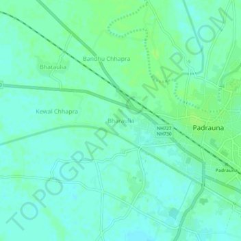
Name: Bharaulia topographic map, elevation, terrain.
Location: Bharaulia, Padrauna, Kushinagar, Uttar Pradesh, 274304, India (26.88478 83.94303 26.92478 83.98303)
Average elevation: 87 m
Minimum elevation: 82 m
Maximum elevation: 91 m
Thank you for supporting this site ❤️
Make a donation
Make a donation
Gear up for your next adventure:
As an Amazon Associate, this site earns from qualifying purchases at no extra cost to you.