
Washington topographic map
Click on the map to display elevation.
About this map
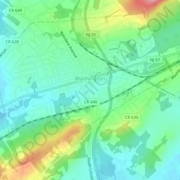
Name: Washington topographic map, elevation, terrain.
Location: Washington, Warren County, New Jersey, 07882, United States (40.74465 -74.99938 40.76852 -74.96211)
Average elevation: 152 m
Minimum elevation: 117 m
Maximum elevation: 235 m
Other topographic maps
Click on a map to view its topography, its elevation and its terrain.
Deer Park Pond
United States > New Jersey > Warren County > Allamuchy Township
Average elevation: 282 m
Harker's Hollow Heights
United States > New Jersey > Warren County > Lopatcong Township
Average elevation: 161 m
Delaware Water Gap
United States > New Jersey > Warren County > Hardwick Township > Dunnfield
Average elevation: 246 m
Columbia Lake
United States > New Jersey > Warren County > Knowlton Township > Warrington
Average elevation: 117 m