
Newport topographic map
Interactive map
Click on the map to display elevation.
About this map
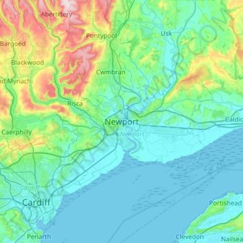
Name: Newport topographic map, elevation, terrain.
Location: Newport, Pays de Galles, NP, Royaume-Uni (51.42823 -3.15750 51.74823 -2.83750)
Average elevation: 89 m
Minimum elevation: 0 m
Maximum elevation: 546 m
Other topographic maps
Click on a map to view its topography, its elevation and its terrain.
Beechwood
Royaume-Uni > Pays de Galles > Newport
Beechwood, Newport, Pays de Galles, NP, Royaume-Uni
Average elevation: 28 m