Geolocate

Somers topographic map

Click on the map to display elevation.

About this map

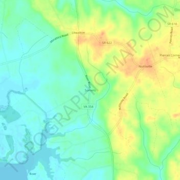
Name: Somers topographic map, elevation, terrain.

Location: Somers, Lancaster County, Virginia, 22528, United States (37.76819 -76.58634 37.80819 -76.54634)

Average elevation: 16 m

Minimum elevation: 0 m

Maximum elevation: 40 m

Other topographic maps

Click on a map to view its topography, its elevation and its terrain.

Irvington

United States > Virginia > Lancaster County

Average elevation: 7 m

Kilmarnock

United States > Virginia > Lancaster County

Average elevation: 16 m

Gear up for your next adventure:

🩹Compact First Aid Kit - Pre-packed essentials for common trail injuries
🧼Biodegradable Camp Soap - Environmentally friendly cleaning for gear and body
🕶️Polarized Sunglasses - Protect your eyes with durable polarized lenses
🥾Light Hiking Boots - Lightweight and comfortable boots for day hikes
🔦LED Headtorch - Bright and durable light for night activities

As an Amazon Associate, this site earns from qualifying purchases at no extra cost to you.