Geolocate

Patao topographic map

Click on the map to display elevation.

About this map

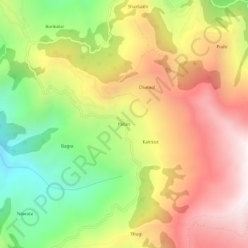
Name: Patao topographic map, elevation, terrain.

Location: Patao, Udhampur, Jammu and Kashmir, 182125, India (33.04497 75.13571 33.08497 75.17571)

Average elevation: 1,787 m

Minimum elevation: 1,148 m

Maximum elevation: 2,409 m

Gear up for your next adventure:

🥾Trail Hiking Boots - Supportive boots for rough trails
🧰Emergency Multi-Tool - Compact multi-tool for outdoor survival
🥾Trail Running Shoes - Lightweight and durable shoes for trail running
🥤Collapsible Travel Cup - Saves space and weight in your mess kit
🧴Insect Repellent - Protect yourself from bugs during outdoor adventures

As an Amazon Associate, this site earns from qualifying purchases at no extra cost to you.