Geolocate

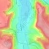
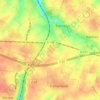
Yport topographic map

Click on the map to display elevation.

About this map

Name: Yport topographic map, elevation, terrain.

Location: Yport, Le Havre, Seine-Maritime, Normandy, Metropolitan France, 76111, France (49.72662 0.29884 49.74173 0.33230)

Average elevation: 59 m

Minimum elevation: 0 m

Maximum elevation: 101 m

Other topographic maps

Click on a map to view its topography, its elevation and its terrain.
Saint-Adrien

France > Normandy > Seine-Maritime > Belbeuf

Average elevation: 56 m

Puys Beach

France > Normandy > Seine-Maritime > Dieppe > Puys

Average elevation: 30 m

Le Pollet

France > Normandy > Seine-Maritime > Torcy-le-Petit

Average elevation: 84 m

Edreville

France > Normandy > Seine-Maritime > Octeville-sur-Mer

Average elevation: 78 m

La Grand Route

France > Normandy > Seine-Maritime > Écalles-Alix

Average elevation: 147 m

La Fresnaye

France > Normandy > Seine-Maritime > Buchy

Average elevation: 201 m

Le Pière

France > Normandy > Seine-Maritime > Étaimpuis

Average elevation: 157 m

Gear up for your next adventure:

🥤Collapsible Travel Cup - Saves space and weight in your mess kit
🧥Thermal Layer - Insulating layer for cold outdoor conditions
🥾Approach Boots - Comfortable boots for hiking and climbing approaches
💧Hydration Pack - Hands-free hydration system for long hikes
🧢Beanie Hat - Keep your head warm in cold weather

As an Amazon Associate, this site earns from qualifying purchases at no extra cost to you.