Geolocate

El Arenal topographic map

Click on the map to display elevation.

About this map

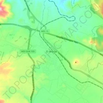
Name: El Arenal topographic map, elevation, terrain.

Location: El Arenal, Región Valles, Jalisco, 45350, Mexico (20.73660 -103.73480 20.81660 -103.65480)

Average elevation: 1,413 m

Minimum elevation: 1,258 m

Maximum elevation: 1,776 m

Gear up for your next adventure:

💡LED Headlamp - Hands-free illumination for night hiking and camping
🔋Emergency Crank Radio - Weather alerts and power without needing batteries
🥾Waterproof Hiking Boots - Essential footwear for rugged terrain and wet Canadian trails
Camping Tent - Weather-resistant tents suitable for 2 to 6 people
🔨Vehicle Emergency Tool - Safety tool for remote road trips to trailheads

As an Amazon Associate, this site earns from qualifying purchases at no extra cost to you.