Geolocate

Masaran topographic map

Click on the map to display elevation.

About this map

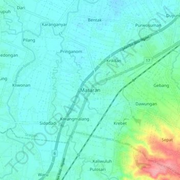
Name: Masaran topographic map, elevation, terrain.

Location: Masaran, Sragen, Central Java, Java, Indonesia (-7.51253 110.88827 -7.43253 110.96827)

Average elevation: 92 m

Minimum elevation: 73 m

Maximum elevation: 182 m

Gear up for your next adventure:

🧭GPS Handheld Device - Reliable GPS navigation for outdoor adventures
🔋Lithium AA Batteries - Long-lasting power that performs in extreme cold
🌬️Windproof Camp Stove - Efficient cooking even on exposed mountain peaks
🧰Multitool Knife - Compact and versatile tool for outdoor use
🚲Handlebar Phone Mount - View topographic-map.com live while cycling

As an Amazon Associate, this site earns from qualifying purchases at no extra cost to you.