
Thank you for supporting this site ❤️
Make a donation
Make a donation
Gear up for your next adventure:
As an Amazon Associate, this site earns from qualifying purchases at no extra cost to you.
Azeba topographic map
Click on the map to display elevation.
Thank you for supporting this site ❤️
Make a donation
Make a donation
Gear up for your next adventure:
As an Amazon Associate, this site earns from qualifying purchases at no extra cost to you.
About this map
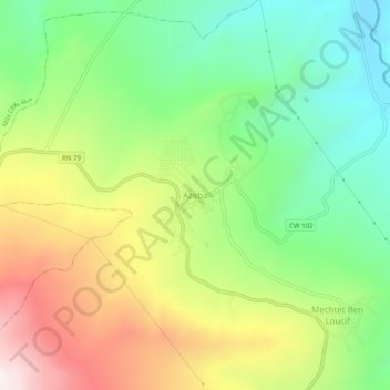
Name: Azeba topographic map, elevation, terrain.
Location: Azeba, Aïn Tinn, Daïra Mila, Mila, 43016, Algérie (36.40749 6.30223 36.44749 6.34223)
Average elevation: 550 m
Minimum elevation: 254 m
Maximum elevation: 982 m
Thank you for supporting this site ❤️
Make a donation
Make a donation
Gear up for your next adventure:
As an Amazon Associate, this site earns from qualifying purchases at no extra cost to you.