Geolocate

Fehmarn topographic map

Click on the map to display elevation.

About this map

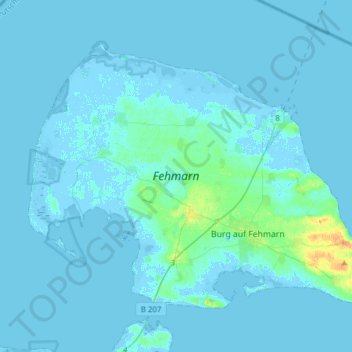
Name: Fehmarn topographic map, elevation, terrain.

Location: Fehmarn, Ostholstein, Schleswig-Holstein, 23769, Germany (54.40137 11.00454 54.53622 11.31286)

Average elevation: 2 m

Minimum elevation: -7 m

Maximum elevation: 26 m

Other topographic maps

Click on a map to view its topography, its elevation and its terrain.

Gear up for your next adventure:

🚲Heavy Duty Bike Lock - Secure your bike at the trailhead or during stops
🧢Hiking Hat - Sun-protective and breathable hats for long treks
👟Sport Hiking Sandals - Breathable footwear for water crossings and camp rest
🍽️Titanium Camping Spork - Ultralight and indestructible eating utensil
Lightweight Backpacking Tent - Compact tent for efficient hiking trips

As an Amazon Associate, this site earns from qualifying purchases at no extra cost to you.