Geolocate

Tenza topographic map

Click on the map to display elevation.

About this map

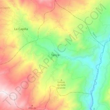
Name: Tenza topographic map, elevation, terrain.

Location: Tenza, Oriente, Boyacá, RAP (Especial) Central, Colombia (5.03673 -73.45979 5.11673 -73.37979)

Average elevation: 1,805 m

Minimum elevation: 1,278 m

Maximum elevation: 2,464 m

Gear up for your next adventure:

Camping Coffee Maker - Brew fresh coffee anywhere on the topographic map
📷Outdoor Action Camera - Capture high-elevation views and rugged adventures
🩹Compact First Aid Kit - Pre-packed essentials for common trail injuries
🛁Quick-Dry Microfiber Towel - Space-saving towel that dries rapidly on the move
🧢Outdoor Cap - Protective cap for sun and rain during hikes

As an Amazon Associate, this site earns from qualifying purchases at no extra cost to you.