Geolocate

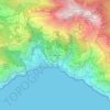
Serre topographic map

Click on the map to display elevation.

About this map

Name: Serre topographic map, elevation, terrain.

Location: Serre, Salerno, Campania, Italy (40.51077 15.01989 40.61625 15.20601)

Average elevation: 307 m

Minimum elevation: 21 m

Maximum elevation: 1,678 m

Other topographic maps

Click on a map to view its topography, its elevation and its terrain.

Castinatelli

Italy > Campania > Salerno

Average elevation: 494 m

Scario

Italy > Campania > Salerno > San Giovanni a Piro

Average elevation: 88 m

Iaconti

Italy > Campania > Salerno > Vietri sul Mare

Average elevation: 285 m

Montepertuso

Italy > Campania > Salerno > Arienzo

Average elevation: 455 m

Pogerola

Italy > Campania > Salerno

Average elevation: 363 m

Marina di Vietri

Italy > Campania > Salerno > Vietri sul Mare

Average elevation: 141 m

Bosco

Italy > Campania > Salerno

Average elevation: 388 m

Monte Cervati

Italy > Campania > Salerno > Sanza

Average elevation: 1,622 m

Ariano

Italy > Campania > Salerno

Average elevation: 281 m

Civitella

Italy > Campania > Salerno > Moio della Civitella

Average elevation: 614 m

Catona

Italy > Campania > Salerno

Average elevation: 428 m

San Severino

Italy > Campania > Salerno > Centola

Average elevation: 273 m

Erchie

Italy > Campania > Salerno > Maiori

Average elevation: 131 m

Iaconti

Italy > Campania > Salerno > Vietri sul Mare

Average elevation: 285 m

Gear up for your next adventure:

🥾Trail Hiking Socks - Comfortable socks to prevent blisters and fatigue
🧊Portable Cooler - Keep food and drinks cold during outdoor adventures
🛏️Sleeping Bag - Warm and compact sleeping bags for outdoor camping
⛺Camping Groundsheet - Protect your tent from moisture and dirt
🧦Hiking Socks - Moisture-wicking and comfortable socks for long hikes

As an Amazon Associate, this site earns from qualifying purchases at no extra cost to you.