Geolocate

North Granby topographic map

Click on the map to display elevation.

About this map

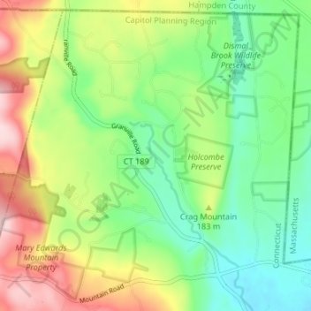
Name: North Granby topographic map, elevation, terrain.

Location: North Granby, Granby, Capitol Planning Region, Connecticut, 06060, United States (41.99183 -72.87872 42.03754 -72.81379)

Average elevation: 163 m

Minimum elevation: 73 m

Maximum elevation: 316 m

Other topographic maps

Click on a map to view its topography, its elevation and its terrain.

Gear up for your next adventure:

❄️Traction Ice Cleats - Slip-on spikes for icy trails and winter hiking
🧭GPS Handheld Device - Reliable GPS navigation for outdoor adventures
🧰Multitool Knife - Compact and versatile tool for outdoor use
🥾Hiking Boots - Sturdy boots providing ankle support and traction on rugged trails
🧦Hiking Liner Socks - Thin base layer to prevent friction and blisters

As an Amazon Associate, this site earns from qualifying purchases at no extra cost to you.