Geolocate

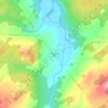
Saint-Martin topographic map

Click on the map to display elevation.

About this map

Name: Saint-Martin topographic map, elevation, terrain.

Location: Saint-Martin, Beauce-Sartigan, Chaudière-Appalaches, Quebec, G0M 1B0, Canada (45.88269 -70.73176 46.04739 -70.56054)

Average elevation: 341 m

Minimum elevation: 196 m

Maximum elevation: 484 m

Other topographic maps

Click on a map to view its topography, its elevation and its terrain.

Lac Douville

Canada > Quebec > Beauce-Sartigan > Saint-Georges

Average elevation: 320 m

Gear up for your next adventure:

🚲Bike Repair Kit - Essential tools for on-trail mechanical issues
🧥Softshell Hiking Jacket - The perfect balance of wind protection and breathability
💡LED Headlamp - Hands-free illumination for night hiking and camping
🛏️Sleeping Bag - Warm and compact sleeping bags for outdoor camping
🧦Hiking Socks - Moisture-wicking and comfortable socks for long hikes

As an Amazon Associate, this site earns from qualifying purchases at no extra cost to you.