Geolocate

Middleton topographic map

Click on the map to display elevation.

About this map

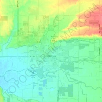
Name: Middleton topographic map, elevation, terrain.

Location: Middleton, Canyon County, Idaho, 83644, United States (43.68483 -116.65286 43.73553 -116.55283)

Average elevation: 741 m

Minimum elevation: 722 m

Maximum elevation: 782 m

Other topographic maps

Click on a map to view its topography, its elevation and its terrain.

Fischer Island

United States > Idaho > Canyon County

Average elevation: 729 m

Gear up for your next adventure:

🥾All-Terrain Hiking Boots - Versatile boots for varied hiking conditions
🧢Sun Hat - Wide-brim hat for sun protection
🧢Beanie Hat - Keep your head warm in cold weather
💧Reusable Water Bottle - Durable water bottles for hydration on trails
🚲Heavy Duty Bike Lock - Secure your bike at the trailhead or during stops

As an Amazon Associate, this site earns from qualifying purchases at no extra cost to you.