Geolocate

Bukal topographic map

Click on the map to display elevation.

About this map

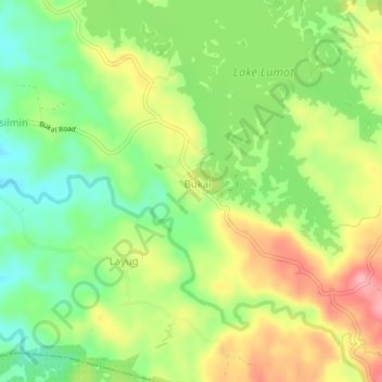
Name: Bukal topographic map, elevation, terrain.

Location: Bukal, Cavinti, Laguna, Calabarzon, 4013, Philippines (14.21848 121.52400 14.25848 121.56400)

Average elevation: 294 m

Minimum elevation: 241 m

Maximum elevation: 359 m

Gear up for your next adventure:

🥾Waterproof Hiking Shoes - Durable shoes for wet and rugged trails
🐕Hiking Dog Pack - Let your canine companion carry their own water and food
🥾Hiking Shoes - Durable and comfortable shoes for trail hiking
🥾Trekking Boots - Durable boots for long-distance trekking
💡Solar Camping Lamp - Eco-friendly lighting for campsites

As an Amazon Associate, this site earns from qualifying purchases at no extra cost to you.