Geolocate

Laren topographic map

Click on the map to display elevation.

About this map

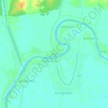
Name: Laren topographic map, elevation, terrain.

Location: Laren, Lamongan, East Java, Java, Indonesia (-6.99838 112.27510 -6.95838 112.31510)

Average elevation: 8 m

Minimum elevation: -1 m

Maximum elevation: 30 m

Other topographic maps

Click on a map to view its topography, its elevation and its terrain.

Sidokumpul

Indonesia > East Java > Lamongan > Sambeng

Average elevation: 74 m

Gondang Dam

Indonesia > East Java > Lamongan > Deketagung

Average elevation: 39 m

Lamongan

Indonesia > East Java > Lamongan

Average elevation: 30 m

Gear up for your next adventure:

🧥Softshell Jacket - Windproof and breathable jacket for hiking
🥘Camping Cookware Set - Compact nesting pots and pans for trail cooking
🛶Canoe Life Vest - Safety vest for water sports
🧴Waterproofing Spray - Restore the DWR coating on jackets and tents
🔥Camping Stove - Portable stoves to cook outdoors with ease

As an Amazon Associate, this site earns from qualifying purchases at no extra cost to you.