
Fondo topographic map
Interactive map
Click on the map to display elevation.
About this map
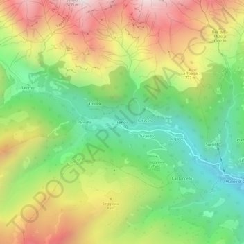
Name: Fondo topographic map, elevation, terrain.
Location: Fondo, Traversella, Turin, Piémont, Italie (45.51175 7.66645 45.55175 7.70645)
Average elevation: 1,513 m
Minimum elevation: 865 m
Maximum elevation: 2,357 m
Other topographic maps
Click on a map to view its topography, its elevation and its terrain.
Durando
Italie > Piémont > Turin > Traversella
Durando, Traversella, Turin, Piémont, Italie
Average elevation: 1,462 m