Geolocate

Turruncún topographic map

Click on the map to display elevation.

About this map

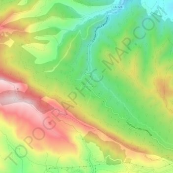
Name: Turruncún topographic map, elevation, terrain.

Location: Turruncún, Arnedo, La Rioja, 26587, España (42.13453 -2.12929 42.17453 -2.08929)

Average elevation: 964 m

Minimum elevation: 710 m

Maximum elevation: 1,268 m

Gear up for your next adventure:

🧴Waterproofing Spray - Restore the DWR coating on jackets and tents
🪜Heavy Duty Carabiners - Multi-use clips for securing gear to your backpack
Backpacking Tent - Lightweight tent for long-distance hiking trips
🛌Down Sleeping Bag - Superior warmth-to-weight ratio for cold nights
👖Convertible Hiking Pants - Zip-off legs to adapt to changing weather conditions

As an Amazon Associate, this site earns from qualifying purchases at no extra cost to you.