Geolocate

Le Moncel topographic map

Click on the map to display elevation.

About this map
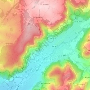
Name: Le Moncel topographic map, elevation, terrain.

Location: Le Moncel, Le Val-d'Ajol, Épinal, Vosges, Grand Est, France métropolitaine, 88340, France (47.91208 6.46245 47.95208 6.50245)

Average elevation: 478 m

Minimum elevation: 333 m

Maximum elevation: 622 m

Other topographic maps

Click on a map to view its topography, its elevation and its terrain.

88340

France > Grand Est > Vosges > Le Val-d'Ajol

Average elevation: 561 m

Gear up for your next adventure:

💡Compact LED Flashlight - Powerful and portable flashlight for outdoor use
🧥Waterproof Hiking Jacket - Protect yourself from rain and wind while hiking
⛺Backpacking Tent - Lightweight tent for long-distance hiking trips
🥾Mountaineering Boots - Supportive boots for climbing and high-altitude hiking
🥫Freeze-Dried Meals - Lightweight, high-calorie nutrition for multi-day treks

As an Amazon Associate, this site earns from qualifying purchases at no extra cost to you.