Geolocate

Chulica topographic map

Click on the map to display elevation.

About this map

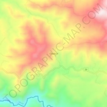
Name: Chulica topographic map, elevation, terrain.

Location: Chulica, Silvia, Centro, Cauca, Colombia (2.58863 -76.44021 2.62863 -76.40021)

Average elevation: 2,509 m

Minimum elevation: 2,186 m

Maximum elevation: 2,792 m

Other topographic maps

Click on a map to view its topography, its elevation and its terrain.

QUIZGO

Colombia > Cauca > Silvia

Average elevation: 2,803 m

Gear up for your next adventure:

🧭GPS Outdoor Watch - Smart watch for navigation and fitness tracking in nature
🥾Hiking Gaiters - Protect legs and shoes from mud, snow, and debris
🧣Evaporative Cooling Towel - Beat the heat during intense summer climbs
Bushcraft Tarp - Versatile emergency shelter or gear protection
🧥Waterproof Hiking Jacket - Protect yourself from rain and wind while hiking

As an Amazon Associate, this site earns from qualifying purchases at no extra cost to you.