Geolocate

Immendingen topographic map

Click on the map to display elevation.

About this map
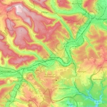
Name: Immendingen topographic map, elevation, terrain.

Location: Immendingen, GVV Immendingen-Geisingen, Landkreis Tuttlingen, Baden-Württemberg, 78194, Germany (47.88549 8.63608 48.00166 8.82474)

Average elevation: 760 m

Minimum elevation: 564 m

Maximum elevation: 951 m

Other topographic maps

Click on a map to view its topography, its elevation and its terrain.

Gear up for your next adventure:

🔨Vehicle Emergency Tool - Safety tool for remote road trips to trailheads
🧰Multitool Knife - Compact and versatile tool for outdoor use
🧴Waterproofing Spray - Restore the DWR coating on jackets and tents
🧴Insect Repellent - Protect yourself from bugs during outdoor adventures
🧢Sun Hat - Wide-brim hat for sun protection

As an Amazon Associate, this site earns from qualifying purchases at no extra cost to you.