Geolocate

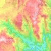
Porqueira topographic map

Click on the map to display elevation.

About this map

Name: Porqueira topographic map, elevation, terrain.

Location: Porqueira, Arzón, Negreira, Barcala, La Coruña, Galicia, 15286, España (42.85692 -8.85008 42.89692 -8.81008)

Average elevation: 322 m

Minimum elevation: 64 m

Maximum elevation: 458 m

Other topographic maps

Click on a map to view its topography, its elevation and its terrain.

Liñaio

España > Galicia > Barcala

Average elevation: 243 m

A Baña

España > Galicia > Barcala

Average elevation: 321 m

Barcala

España > Galicia > Barcala

Average elevation: 289 m

Broño

España > Galicia > Barcala

Average elevation: 258 m

Negreira

España > Galicia > Barcala

Average elevation: 266 m

A Baña

España > Galicia > Barcala

Average elevation: 321 m

Gear up for your next adventure:

🧴First Aid Kit - Essential first aid supplies for outdoor emergencies
🦶Hiking Shoe Insoles - Added support for high arches and long days on feet
🧥Fleece Jacket - Warm and lightweight jacket for layering
💡Compact LED Flashlight - Powerful and portable flashlight for outdoor use
🦌Outdoor Trail Camera - Monitor wildlife activity near your favorite spots

As an Amazon Associate, this site earns from qualifying purchases at no extra cost to you.