Geolocate

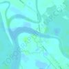
Libtong topographic map

Click on the map to display elevation.

About this map

Name: Libtong topographic map, elevation, terrain.

Location: Libtong, Meycauayan, Bulacan, Central Luzon, Philippines (14.73930 120.97353 14.75382 120.98731)

Average elevation: 13 m

Minimum elevation: 1 m

Maximum elevation: 26 m

Other topographic maps

Click on a map to view its topography, its elevation and its terrain.
Iba

Philippines > Bulacan > Meycauayan

Average elevation: 17 m

Meycauayan River

Philippines > Bulacan > Meycauayan > Ubihan

Average elevation: 2 m

Gear up for your next adventure:

🧢Sun Hat - Wide-brim hat for sun protection
💡Solar Camping Lamp - Eco-friendly lighting for campsites
🧢Hiking Sun Hat - Wide-brimmed protection for exposed mountain ridges
🧥Softshell Jacket - Windproof and breathable jacket for hiking
🧴First Aid Kit - Essential first aid supplies for outdoor emergencies

As an Amazon Associate, this site earns from qualifying purchases at no extra cost to you.