Geolocate

Green Pond topographic map

Click on the map to display elevation.

About this map

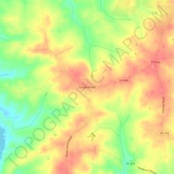
Name: Green Pond topographic map, elevation, terrain.

Location: Green Pond, Pittsylvania County, Virginia, United States (36.86125 -79.52892 36.90125 -79.48892)

Average elevation: 268 m

Minimum elevation: 226 m

Maximum elevation: 297 m

Other topographic maps

Click on a map to view its topography, its elevation and its terrain.

Gretna

United States > Virginia > Pittsylvania County

Average elevation: 253 m

Hurt

United States > Virginia > Pittsylvania County

Average elevation: 194 m

Gretna

United States > Virginia > Pittsylvania County

Average elevation: 253 m

Chatham

United States > Virginia > Pittsylvania County

Average elevation: 209 m

Chatham

United States > Virginia > Pittsylvania County

Average elevation: 209 m

Gear up for your next adventure:

🧥Softshell Hiking Jacket - The perfect balance of wind protection and breathability
🧥Waterproof Pants - Keep dry during rainy hiking conditions
🛶Kayak Accessories - Essential gear for safe and fun kayaking adventures
🎒Hiking Daypack - Lightweight and durable backpacks for day trips and excursions
🧥Fleece Jacket - Warm and lightweight jacket for layering

As an Amazon Associate, this site earns from qualifying purchases at no extra cost to you.