Geolocate

Mende topographic map

Click on the map to display elevation.

About this map

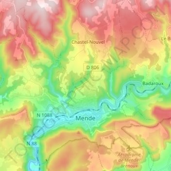
Name: Mende topographic map, elevation, terrain.

Location: Mende, Lozère, Occitania, Metropolitan France, 48000, France (44.49385 3.42873 44.57582 3.55340)

Average elevation: 976 m

Minimum elevation: 690 m

Maximum elevation: 1,294 m

Other topographic maps

Click on a map to view its topography, its elevation and its terrain.

Gear up for your next adventure:

💡Solar Camping Lamp - Eco-friendly lighting for campsites
🍽️Titanium Camping Spork - Ultralight and indestructible eating utensil
🧭GPS Handheld Device - Reliable GPS navigation for outdoor adventures
🧢Sun Protection Cap - Breathable cap to protect from sun exposure
🔭Outdoor Binoculars - Lightweight binoculars for birdwatching and hiking

As an Amazon Associate, this site earns from qualifying purchases at no extra cost to you.