Geolocate

Patan topographic map

Click on the map to display elevation.

Patan

Patan is located at 17°22′N 73°54′E / 17.37°N 73.9°E / 17.37; 73.9. It has an average elevation of 582 metres (1909 feet).

Wikipedia (CC-BY-SA 3.0)

About this map

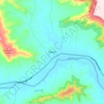
Name: Patan topographic map, elevation, terrain.

Location: Patan, Satara, Maharashtra, 415206, India (17.33644 73.86031 17.41644 73.94031)

Average elevation: 668 m

Minimum elevation: 564 m

Maximum elevation: 1,092 m

Gear up for your next adventure:

🧴Bear Spray Holster - Quick-access carry for essential Canadian wilderness safety
💡Compact LED Flashlight - Powerful and portable flashlight for outdoor use
🧰Multitool Knife - Compact and versatile tool for outdoor use
🥾Lightweight Hiking Boots - Boots for comfort and mobility on long hikes
🏃Hydration Running Vest - Carry water and maps close to your body for speed

As an Amazon Associate, this site earns from qualifying purchases at no extra cost to you.