Geolocate

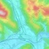
Kalwang topographic map

Click on the map to display elevation.

About this map

Name: Kalwang topographic map, elevation, terrain.

Location: Kalwang, Bezirk Leoben, Styria, 8775, Austria (47.38352 14.69960 47.49141 14.84793)

Average elevation: 1,217 m

Minimum elevation: 689 m

Maximum elevation: 2,093 m

Other topographic maps

Click on a map to view its topography, its elevation and its terrain.
Schafloch

Austria > Styria > Bezirk Leoben > Eisenerz

Average elevation: 932 m

Liesingtal

Austria > Styria > Bezirk Leoben > Brunn

Average elevation: 702 m

Gear up for your next adventure:

🔦LED Headlamp - Hands-free lighting for early morning starts or late finishes
⛺Backpacking Tent - Lightweight tent for long-distance hiking trips
🥾Hiking Shorts - Breathable shorts suitable for summer hikes
🧢Beanie Hat - Keep your head warm in cold weather
🧊Insulated Water Bottle - Keeps drinks cold in summer and prevents freezing in winter

As an Amazon Associate, this site earns from qualifying purchases at no extra cost to you.