Geolocate

Pangandaran topographic map

Click on the map to display elevation.

About this map
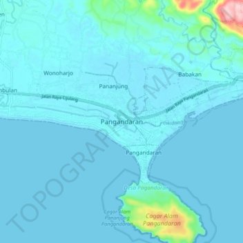
Name: Pangandaran topographic map, elevation, terrain.

Location: Pangandaran, West Java, 46396, Indonesia (-7.84521 108.48996 -7.52521 108.80996)

Average elevation: 72 m

Minimum elevation: -3 m

Maximum elevation: 648 m

Gear up for your next adventure:

🧴Outdoor Sunscreen - High SPF protection for high-altitude UV exposure
🧤Rechargeable Heated Gloves - Extreme warmth for Canadian winter expeditions
⛺Bushcraft Tarp - Versatile emergency shelter or gear protection
🧳Compression Sacks - Maximize space in your backpack by shrinking gear
🧦Merino Wool Socks - Moisture-wicking comfort for long-distance hiking

As an Amazon Associate, this site earns from qualifying purchases at no extra cost to you.