Geolocate

Gusselby topographic map

Click on the map to display elevation.

About this map

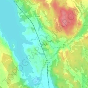
Name: Gusselby topographic map, elevation, terrain.

Location: Gusselby, Lindesbergs kommun, Örebro County, 711 32, Sweden (59.62538 15.19854 59.66538 15.23854)

Average elevation: 87 m

Minimum elevation: 58 m

Maximum elevation: 139 m

Other topographic maps

Click on a map to view its topography, its elevation and its terrain.

Hallsbergs kommun

Sweden > Örebro County

Average elevation: 92 m

Malingsbo-Kloten

Sweden > Örebro County

Average elevation: 274 m

Laxå kommun

Sweden > Örebro County

Average elevation: 116 m

Örebro kommun

Sweden > Örebro County

Average elevation: 64 m

Örebro kommun

Sweden > Örebro County

Average elevation: 64 m

Gear up for your next adventure:

🥾Lightweight Hiking Boots - Boots for comfort and mobility on long hikes
🧼Biodegradable Camp Soap - Environmentally friendly cleaning for gear and body
🥾Light Trekking Boots - Supportive boots for multi-day treks
🧤Rechargeable Heated Gloves - Extreme warmth for Canadian winter expeditions
🧥Softshell Hiking Jacket - The perfect balance of wind protection and breathability

As an Amazon Associate, this site earns from qualifying purchases at no extra cost to you.