Geolocate

Longwy topographic map

Click on the map to display elevation.

About this map
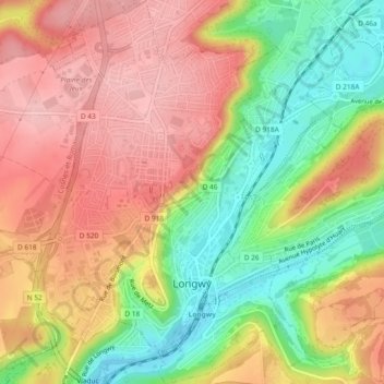
Name: Longwy topographic map, elevation, terrain.

Location: Longwy, Val-de-Briey, Meurthe-et-Moselle, Grand Est, Metropolitan France, 54400, France (49.50657 5.74539 49.53688 5.78840)

Average elevation: 332 m

Minimum elevation: 250 m

Maximum elevation: 398 m

Other topographic maps

Click on a map to view its topography, its elevation and its terrain.
Gear up for your next adventure:

☕Camping Coffee Maker - Brew fresh coffee anywhere on the topographic map
🧴Bear Spray Holster - Quick-access carry for essential Canadian wilderness safety
🥾Approach Boots - Comfortable boots for hiking and climbing approaches
🧳Compression Sacks - Maximize space in your backpack by shrinking gear
🚲Bike Repair Kit - Essential tools for on-trail mechanical issues

As an Amazon Associate, this site earns from qualifying purchases at no extra cost to you.