Geolocate

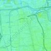
Kramat Jati topographic map

Click on the map to display elevation.

About this map

Name: Kramat Jati topographic map, elevation, terrain.

Location: Kramat Jati, East Jakarta, Special Capital Region of Jakarta, Indonesia (-6.30660 106.84677 -6.24309 106.88427)

Average elevation: 31 m

Minimum elevation: 11 m

Maximum elevation: 49 m

Other topographic maps

Click on a map to view its topography, its elevation and its terrain.

Gear up for your next adventure:

🧥Softshell Jacket - Windproof and breathable jacket for hiking
🥾Lightweight Hiking Shoes - Comfortable shoes for day hikes
🗺️Topographic Maps - Detailed maps to explore trails, mountains, and wilderness areas
🔋Solar Power Bank - Keep your GPS and devices charged during long outdoor trips
🕶️Polarized Sunglasses - Protect your eyes with durable polarized lenses

As an Amazon Associate, this site earns from qualifying purchases at no extra cost to you.