Geolocate

Kimobetsu topographic map

Click on the map to display elevation.

About this map
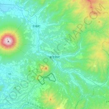
Name: Kimobetsu topographic map, elevation, terrain.

Location: Kimobetsu, Abuta County, Shiribeshi Subprefecture, Hokkaido Prefecture, Hokkaido Region, Japan (42.71475 140.80684 42.88587 141.10712)

Average elevation: 482 m

Minimum elevation: 174 m

Maximum elevation: 1,874 m

Other topographic maps

Click on a map to view its topography, its elevation and its terrain.

Niseko Annupuri

Japan > Abuta County > Kutchan

Average elevation: 879 m

Hirafu West Village

Japan > Abuta County > Kutchan

Average elevation: 281 m

Gear up for your next adventure:

🧤Insulated Winter Gloves - Heavy-duty protection for sub-zero Canadian adventures
💡Portable Camping Lamp - Rechargeable lamp for campsite lighting
🧦Hiking Socks - Moisture-wicking and comfortable socks for long hikes
🥾Trail Hiking Socks - Comfortable socks to prevent blisters and fatigue
🧥Insulated Jacket - Keep warm in cold outdoor conditions

As an Amazon Associate, this site earns from qualifying purchases at no extra cost to you.