Geolocate

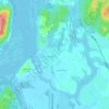
Corral topographic map

Click on the map to display elevation.

About this map

Name: Corral topographic map, elevation, terrain.

Location: Corral, Provincia de Valdivia, Los Ríos, Chile (-40.11632 -73.70728 -39.85126 -73.13842)

Average elevation: 232 m

Minimum elevation: -2 m

Maximum elevation: 1,036 m

Other topographic maps

Click on a map to view its topography, its elevation and its terrain.
Antilhue

Chile > Los Ríos > Provincia de Valdivia > Los Lagos

Average elevation: 37 m

Cabo Blanco

Chile > Los Ríos > Provincia de Valdivia > Valdivia

Average elevation: 15 m

Parque Oncol

Chile > Los Ríos > Provincia de Valdivia > Valdivia

Average elevation: 368 m

Neltume

Chile > Los Ríos > Provincia de Valdivia > Panguipulli

Average elevation: 599 m

Chan Chan

Chile > Los Ríos > Provincia de Valdivia > Mariquina

Average elevation: 101 m

Gear up for your next adventure:

🧢Outdoor Visor - Breathable visor for sunny hikes
🥾Durable Hiking Shoes - Long-lasting shoes for frequent hiking
🥾Hiking Leggings - Comfortable leggings for outdoor activities
🦯Trekking Poles - Reduced impact on joints for steep topographic climbs
🧭GPS Outdoor Watch - Smart watch for navigation and fitness tracking in nature

As an Amazon Associate, this site earns from qualifying purchases at no extra cost to you.