Geolocate

Farouk topographic map

Click on the map to display elevation.

About this map

Name: Farouk topographic map, elevation, terrain.

Location: Farouk, Port Said, 42519, Egypt (31.23944 32.26528 31.27944 32.30528)

Average elevation: 4 m

Minimum elevation: -7 m

Maximum elevation: 22 m

Other topographic maps

Click on a map to view its topography, its elevation and its terrain.
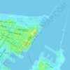
History Garden

Egypt > Port Said > Port Said

Average elevation: 3 m

Gear up for your next adventure:

🧥Fleece Jacket - Warm and lightweight jacket for layering
👟Leg Gaiters - Keep debris, mud, and snow out of your boots
🎒Hiking Daypack - Lightweight and durable backpacks for day trips and excursions
💡Portable Camping Lamp - Rechargeable lamp for campsite lighting
🚲Bike Repair Kit - Essential tools for on-trail mechanical issues

As an Amazon Associate, this site earns from qualifying purchases at no extra cost to you.