Geolocate

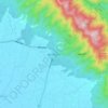
Sarawal topographic map

Click on the map to display elevation.

About this map

Name: Sarawal topographic map, elevation, terrain.

Location: Sarawal, Nawalparasi W, Lumbini Province, Nepal (27.40971 83.69937 27.60897 83.77007)

Average elevation: 140 m

Minimum elevation: 99 m

Maximum elevation: 850 m

Other topographic maps

Click on a map to view its topography, its elevation and its terrain.
Bardaghat

Nepal > Lumbini Province > Nawalparasi W

Average elevation: 241 m

Gear up for your next adventure:

🧢Beanie Hat - Keep your head warm in cold weather
🦶Anti-Blister Balm - Prevents friction and hotspots during long ascents
👟Leg Gaiters - Keep debris, mud, and snow out of your boots
👟Trail Running Shoes - Agile footwear for fast-paced topographic exploration
🧴Sunscreen SPF - Broad-spectrum sunscreen for outdoor activities

As an Amazon Associate, this site earns from qualifying purchases at no extra cost to you.