Geolocate

Jonancy topographic map

Click on the map to display elevation.

About this map
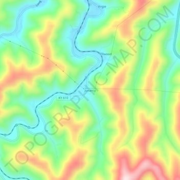
Name: Jonancy topographic map, elevation, terrain.

Location: Jonancy, Pike County, Kentucky, 41538, United States (37.29649 -82.60293 37.33649 -82.56293)

Average elevation: 399 m

Minimum elevation: 253 m

Maximum elevation: 619 m

Other topographic maps

Click on a map to view its topography, its elevation and its terrain.
Pikeville

United States > Kentucky > Pike County

Average elevation: 338 m

Elkhorn City

United States > Kentucky > Pike County

Average elevation: 364 m

Crow Hollow

United States > Kentucky > Pike County > Douglas

Average elevation: 348 m

Gear up for your next adventure:

🥾Mountaineering Boots - Supportive boots for climbing and high-altitude hiking
🧴Waterproofing Spray - Restore the DWR coating on jackets and tents
💧Filtered Water Bottle - Safe drinking water on the go
💧Hydration Pack - Hands-free hydration system for long hikes
🏃Hydration Running Vest - Carry water and maps close to your body for speed

As an Amazon Associate, this site earns from qualifying purchases at no extra cost to you.