
Kuurne topographic map
Interactive map
Click on the map to display elevation.
About this map
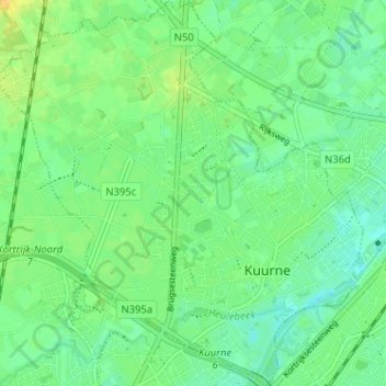
Name: Kuurne topographic map, elevation, terrain.
Location: Kuurne, Kortrijk, West Flanders, Flanders, 8520, Belgium (50.83956 3.24044 50.87989 3.30160)
Average elevation: 17 m
Minimum elevation: 7 m
Maximum elevation: 30 m