Geolocate

Carolina topographic map

Click on the map to display elevation.

About this map
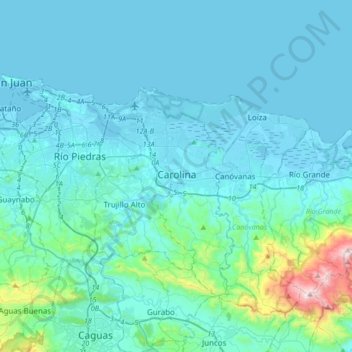
Name: Carolina topographic map, elevation, terrain.

Location: Carolina, Puerto Rico, 00988, United States (18.22085 -66.11702 18.54085 -65.79702)

Average elevation: 99 m

Minimum elevation: -3 m

Maximum elevation: 1,035 m

Gear up for your next adventure:

🧢Hiking Hat - Sun-protective and breathable hats for long treks
🧴First Aid Kit - Essential first aid supplies for outdoor emergencies
🧥Waterproof Hiking Jacket - Protect yourself from rain and wind while hiking
🥾Mountaineering Boots - Supportive boots for climbing and high-altitude hiking
🚲Heavy Duty Bike Lock - Secure your bike at the trailhead or during stops

As an Amazon Associate, this site earns from qualifying purchases at no extra cost to you.