Geolocate

Jatani topographic map

Click on the map to display elevation.

About this map

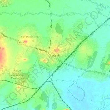
Name: Jatani topographic map, elevation, terrain.

Location: Jatani, Khordha, Odisha, 752050, India (20.12174 85.66524 20.20174 85.74524)

Average elevation: 26 m

Minimum elevation: 7 m

Maximum elevation: 73 m

Other topographic maps

Click on a map to view its topography, its elevation and its terrain.

Jatani

India > Odisha > Jatani

Average elevation: 32 m

Gear up for your next adventure:

🔭Outdoor Binoculars - Lightweight binoculars for birdwatching and hiking
🎒Backpack Rain Cover - External shield to keep your entire pack dry
🥾Trekking Boots - Durable boots for long-distance trekking
Backpacking Tent - Lightweight tent for long-distance hiking trips
🏃Hydration Running Vest - Carry water and maps close to your body for speed

As an Amazon Associate, this site earns from qualifying purchases at no extra cost to you.