Geolocate

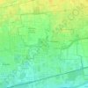
Castano Primo topographic map

Click on the map to display elevation.

About this map

Name: Castano Primo topographic map, elevation, terrain.

Location: Castano Primo, Milano, Lombardia, 20022, Italia (45.52312 8.71100 45.57347 8.80986)

Average elevation: 178 m

Minimum elevation: 129 m

Maximum elevation: 205 m

Other topographic maps

Click on a map to view its topography, its elevation and its terrain.

San Pietro all'Olmo

Italia > Lombardia > Milano > Cornaredo

Average elevation: 142 m

Milano 3

Italia > Lombardia > Milano

Average elevation: 100 m

Molino Ortolina

Italia > Lombardia > Milano > Pioltello

Average elevation: 123 m

Malvaglio

Italia > Lombardia > Milano > Robecchetto con Induno

Average elevation: 160 m

Monluè

Italia > Lombardia > Milano > Milano

Average elevation: 112 m

Cascina Villa

Italia > Lombardia > Milano > Lainate

Average elevation: 166 m

Gear up for your next adventure:

🥾Hiking Shoes - Durable and comfortable shoes for trail hiking
🔦UV Flashlight - Detect minerals or specific insects in the dark
🧶550 Survival Paracord - Versatile utility cord for emergency repairs and rigging
🥘Camping Cookware Set - Compact nesting pots and pans for trail cooking
💧Filtered Water Bottle - Safe drinking water on the go

As an Amazon Associate, this site earns from qualifying purchases at no extra cost to you.