
Thank you for supporting this site ❤️
Make a donation
Make a donation
Gear up for your next adventure:
As an Amazon Associate, this site earns from qualifying purchases at no extra cost to you.
Negal topographic map
Click on the map to display elevation.
Thank you for supporting this site ❤️
Make a donation
Make a donation
Gear up for your next adventure:
As an Amazon Associate, this site earns from qualifying purchases at no extra cost to you.
About this map
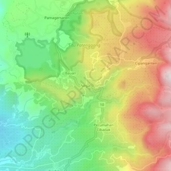
Name: Negal topographic map, elevation, terrain.
Location: Negal, Rancabali, Bandung, West Java, Java, 40973, Indonesia (-7.19473 107.35011 -7.15473 107.39011)
Average elevation: 1,710 m
Minimum elevation: 1,415 m
Maximum elevation: 2,074 m
Thank you for supporting this site ❤️
Make a donation
Make a donation
Gear up for your next adventure:
As an Amazon Associate, this site earns from qualifying purchases at no extra cost to you.