Geolocate

Toroh topographic map

Click on the map to display elevation.

About this map

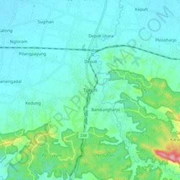
Name: Toroh topographic map, elevation, terrain.

Location: Toroh, Grobogan, Central Java, Java, 58171, Indonesia (-7.20336 110.86302 -7.12336 110.94302)

Average elevation: 55 m

Minimum elevation: 26 m

Maximum elevation: 185 m

Gear up for your next adventure:

🥾Approach Shoes - Shoes designed for climbing approaches and rugged trails
🧤Thermal Hiking Gloves - Grip-enhanced gloves for cold-weather altitude trekking
🔭Outdoor Binoculars - Lightweight binoculars for birdwatching and hiking
🥾Light Hiking Boots - Lightweight and comfortable boots for day hikes
🧥Waterproof Jacket - Lightweight rain jackets for hiking and outdoor activities

As an Amazon Associate, this site earns from qualifying purchases at no extra cost to you.