Geolocate

Wedi topographic map

Click on the map to display elevation.

About this map

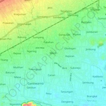
Name: Wedi topographic map, elevation, terrain.

Location: Wedi, Klaten, Central Java, Java, 57421, Indonesia (-7.78594 110.53992 -7.70594 110.61992)

Average elevation: 142 m

Minimum elevation: 112 m

Maximum elevation: 229 m

Other topographic maps

Click on a map to view its topography, its elevation and its terrain.

Sanggrahan

Indonesia > Central Java > Klaten

Average elevation: 150 m

Sungai

Indonesia > Central Java > Klaten > Nanggulan

Average elevation: 113 m

Gear up for your next adventure:

🛶Kayak Accessories - Essential gear for safe and fun kayaking adventures
🔦LED Flashlight - Powerful and long-lasting flashlight for camping and emergencies
🥾Light Hiking Boots - Lightweight and comfortable boots for day hikes
🎒Backpack Rain Cover - External shield to keep your entire pack dry
🧴Sunscreen SPF - Broad-spectrum sunscreen for outdoor activities

As an Amazon Associate, this site earns from qualifying purchases at no extra cost to you.