Geolocate

Mojosongo topographic map

Click on the map to display elevation.

About this map

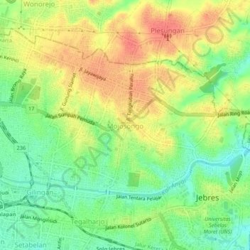
Name: Mojosongo topographic map, elevation, terrain.

Location: Mojosongo, Surakarta, Central Java, Java, 57127, Indonesia (-7.56347 110.82191 -7.52347 110.86191)

Average elevation: 111 m

Minimum elevation: 83 m

Maximum elevation: 139 m

Other topographic maps

Click on a map to view its topography, its elevation and its terrain.

Gear up for your next adventure:

🧥Waterproof Pants - Keep dry during rainy hiking conditions
🥾Mountain Trail Shoes - High-traction shoes for mountain trails
🧥Thermal Layer - Insulating layer for cold outdoor conditions
Camping Essentials - All-in-one gear for a comfortable camping trip
🧦Hiking Liner Socks - Thin base layer to prevent friction and blisters

As an Amazon Associate, this site earns from qualifying purchases at no extra cost to you.