
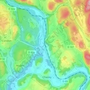
Chazey-Bons topographic map
Interactive map
Click on the map to display elevation.
About this map
Name: Chazey-Bons topographic map, elevation, terrain.
Average elevation: 297 m
Minimum elevation: 224 m
Maximum elevation: 461 m
Other topographic maps
Click on a map to view its topography, its elevation and its terrain.
Pugieu
France > Auvergne-Rhône-Alpes > Ain > Chazey-Bons
Pugieu, Chazey-Bons, Belley, Ain, Auvergne-Rhône-Alpes, France métropolitaine, 01510, France
Average elevation: 361 m
Rothonod
France > Auvergne-Rhône-Alpes > Ain > Chazey-Bons
Rothonod, Chazey-Bons, Belley, Ain, Auvergne-Rhône-Alpes, France métropolitaine, 01300, France
Average elevation: 282 m