
Oordegem topographic map
Interactive map
Click on the map to display elevation.
About this map
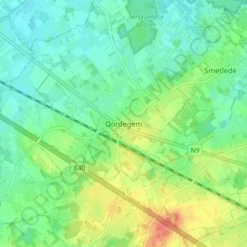
Name: Oordegem topographic map, elevation, terrain.
Location: Oordegem, Lede, Flandre orientale, Flandre, 9521, Belgique (50.93740 3.88209 50.97740 3.92209)
Average elevation: 28 m
Minimum elevation: 10 m
Maximum elevation: 64 m