Geolocate

Fabriano topographic map

Click on the map to display elevation.

About this map

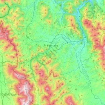
Name: Fabriano topographic map, elevation, terrain.

Location: Fabriano, Ancona, 60044, Italy (43.20992 12.75826 43.43113 13.06489)

Average elevation: 565 m

Minimum elevation: 159 m

Maximum elevation: 1,426 m

Other topographic maps

Click on a map to view its topography, its elevation and its terrain.

Precicchie

Italy > Ancona > Fabriano

Average elevation: 493 m

Gear up for your next adventure:

🧰Multitool Knife - Compact and versatile tool for outdoor use
🧶550 Survival Paracord - Versatile utility cord for emergency repairs and rigging
🧣Merino Neck Gaiter - Protects against wind, sun, and cold at high altitudes
🥾Approach Shoes - Shoes designed for climbing approaches and rugged trails
Lightweight Camping Tent - Portable shelter optimized for Canadian backcountry camping

As an Amazon Associate, this site earns from qualifying purchases at no extra cost to you.